Introduction
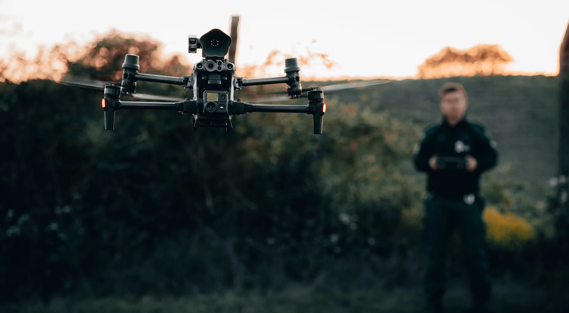
Emergency response situations demand timely and well-informed decision-making to coordinate efforts and save lives. However, major disasters and crises can often obscure visibility and limit situational awareness on the ground. Drones equipped with high-definition cameras have emerged as a game-changing technology for providing aerial surveillance and live video streaming capabilities over emergency scenes. It allows first responders to safely gain a comprehensive real-time overview from above, aiding faster and more strategic operations.
Wildfire Surveillance
Drones give firefighters an important upper hand in battling the often unpredictable and volatile nature of wildfires. Through live-streamed aerial footage, command teams gain unparalleled comprehensive insights into fire behavior that can rapidly change directions under differing wind and temperature conditions. Drones can hover precisely over burning zones and pan across wide perimeters to fully map the leading edges and internal hotspots fueling fire growth. Thermal cameras detect even the faintest signs of residual heat months after surface flames appear extinguished, helping to avoid costly reignition events.
The real-time video provided by drones is also instrumental in safely maneuvering ground crews. The live feed enables commanders to track personnel deployments about shifting fire lines and smoke activity. They can reroute teams or call for immediate evacuation if surging flames or smoke threaten to overtake an area. Air tankers are guided to water drops with pinpoint accuracy thanks to the bird’s eye view of which edge of the firefront needs priority containment or where embers have breached containment lines. Drones even help coordinate controlled backburn operations by providing a constant awareness of weather patterns influencing burn progression before backup arrives.
As wildfire seasons grow longer and more extreme with climate change, drones will play an increasingly central role in fire response. Their endurance of up to 30 minutes per battery compared to 15-minute helicopter durations allows sustained coverage even as conditions rapidly evolve. Research is also developing more autonomous drone swarms that can map fires collectively across hundreds of acres per hour, boosting situational understanding exponentially. If paired with advanced sensors, drones may one day detect dangerous gas buildups or structural vulnerabilities amid the flames in real time, further augmenting decision-making. Lives and property losses will continue to be spared thanks to the unmatched views of fiery threats that life-saving drones uniquely deliver.
Hurricane Rescue and Damage Assessment
The role of drones becomes even more vital in hurricane response at night, when storms often make landfall under the cover of darkness. Infrared and thermal cameras allow drones to effectively “see” people despite no available light sources through their body heat signatures. Those stranded on rooftops post-flooding or clinging to debris drifting at sea amid massive swells are easily spotted from above. Emergency responders harnessing drone-fed night vision footage can confidently navigate treacherous conditions thanks to aerial guidance pinpointing victims in need of immediate extraction.
Comprehensive post-storm surveys are also enabled around the clock by drones. Within hours of hazardous hurricane winds subsiding, drones rapidly map the extensive damage across cities, towns, and infrastructure otherwise inaccessible. Live broadcasts reveal which neighborhoods suffered the worst impacts requiring the most urgent relief provisions or search crews. Footage clues emergency planners into which roads, bridges, and utility lines devastated travel routes or utility restoration. Drones even pinpoint environmental dangers like downed power lines submerged underwater or chemical leaks from flooded industrial zones.
As recovery transitions from response, continued damage assessment by drone aids longer-term redevelopment planning. Repeated aerial surveys document changes to coastlines, structures increasingly at risk of collapse, and floodwater recession over time. Live broadcasts serve as invaluable virtual archives to guide decisions on rebuilding priorities, zoning reevaluations, and hazard mitigation projects to strengthen community resilience against future storms. Insurance claims are also expedited thanks to the comprehensive visual records captured from above. Undoubtedly, drones performing critical hurricane surveillance via real-time video streaming have revolutionized all facets from life-saving operations to long-term recovery.
Natural Disaster Response
When flooding or landslides occur abruptly due to major precipitation, infrastructure failures, or seismic activity, the ability of drones to rapidly launch and begin streaming aerial views is invaluable. Quickly gaining an eagle-eyed perspective of widespread damage or impacted areas that may otherwise be unreachable transforms response objectives from general assumptions to targeted missions based on real visual cues. Drones can immediately observe the full extent of mud and debris flows kicked up by landslides or flash flooding to boundary-safe zones for rescuers to enter while avoiding further risks.
Thermal cameras aboard drones also aid in locating survivors amid landscapes transformed by natural disasters. The technology detects body heat through passing cloud cover or darkness to guide field teams to undiscovered victims. As the most hazardous initial post-disaster periods pass, continuous overhead tracking of affected sites via live feeds informs changing priorities. Drones monitor ongoing situations like unstable slopes, cracked dams, or contaminated waterways to pivot resources accordingly based on visual triggers without endangering additional response personnel.
Paired with advanced sensors, drones may soon provide even richer data streams to emergency coordinators. Attachable gas detectors could identify methane leaks or chemical spills before responders arrive. Seismometers may directly record aftershock activities. Through integration with other tools like AI and 3D mapping, drones are primed to develop virtual replicas of devastated zones from streaming imagery. Such augmented awareness will empower evidence-based decision-making far surpassing ground-level comprehension alone. Drones establishing situational command from above will undoubtedly revolutionize all-natural disaster mitigation and recovery efforts.
Continued Development
As drone and pilot certifications evolve to meet the unique demands of emergency incident management, multi-agency coordination, and standard operating protocols will facilitate seamless drone integration into responses. Communities are establishing public safety drone programs to equip and train dedicated pilots for 24/7 deployment. When disasters strike, these verified pilots will launch pre-approved drone fleets carrying an array of investigatory sensors directly to incident commanders.
Advanced drones increasingly offer swappable payloads so a single system may rapidly transform between cameras, gas detectors, or other critical tools based on changing conditions conveyed through live video. Additional sensors like loudspeakers may assist with evacuation directives or missing person searches assisted by audio feedback. Autonomous flight capabilities also lend more endurance by offloading piloting tasks as drones weave between pre-set waypoints or track targets of interest. This allows sustained operations even as extreme weather impacts visibility.
As regulations evolve, incident drones may one day transmit real-time analytics overlays onto video by integrating computer vision algorithms. Object detection tools could automatically flag needs like vulnerable infrastructure or exposed utilities for swifter response while pilots focus on broader views. By pairing with unified data frameworks, all response stakeholders will access one shared incident picture regardless of location. Lessons from each disaster will similarly feed performance enhancements through national research initiatives centered on drone-derived data and best practices.
Always prioritizing safety, regulations must iterate fast enough that public safety drones stay ahead of emerging threats and crises enabled by climate change. With such continual refinement, drones will uncover growing roles from hazmat detection and fire mapping to coastal erosion monitoring or infrastructure inspections. Real-time video access from an armada of intelligent drones stands to transform emergency management into a predictive, omni-aware discipline saving more lives than ever before.
Conclusion
In closing, drone footage streaming has proven a revolutionary surveillance method for coordinating emergency response by supplying otherwise unattainable real-time aerial views. Situational awareness transformation saves lives during time-critical operations across natural disasters and hazardous events. Advancing smart applications aids in improved emergency preparedness and community resilience worldwide. Live drone video represents a flight into the future of lifesaving for disaster relief teams.


